BGHES Final ESIA Documents
- Cover Section for Shared Annexure File
- Access Road ESIA_V5.0_COMP_2021-11-09
- Access Road ESMP_V5.0_COMP_2021-11-10
- Dam ESIA_V5.0_COMP_2021-11-09
- Dam ESMP_V5.0_COMP_2021-11-10
- OESMP_V5.0_COMP_2021-12-10
- Transmission Line ESIA_V5.0_COMP_2021-11-10
- Transmission Line ESMP_V5.0_COMP_2021-11-10
- Shared Annexure_COMP_V5.0_2021-11-11
Investors Conference Documents
- Project Overview Document | PDF, 3.4MB
- Conference Program | PDF, 0.6MB
- Project Brief (Brochure) | PDF, 9.3MB
Conference Speeches and Presentations
- Speech by the Minister Of Energy-Zambia, Hon. David Mabumba | PDF, 0.6MB
- Remarks by the Minister Of Energy-Zimbabwe, Hon. Dr. Samuel Undenge | PDF, 0.3MB
- Statement by the Minister Of Finance-Zimbabwe, Hon. Patrick A. Chinamasa | PDF, 0.7MB
- Speech by the Minister of Finance-Zambia, Hon. Felix C. Mutati | PDF, 0.4MB
- Speech by the Vice President Of Zambia, Her Honour Mrs. Inonge Mutukwa Wina | PDF, 0.5MB
- Keynote Speech For the Batoka Gorge Hydro Electric Scheme, AFDB | PDF, 0.7MB
- Closing Remarks by the Permanent Secretary of Energy, Brig. Gen. Emelda Chola | PDF, 0.3MB
- Batoka Gorge Hydro-Electric Scheme Investor Conference | PDF, 2.2MB
Project Site Location
The proposed Batoka Gorge Hydro-Electric Scheme (HES) is strategically located on the Zambezi River, one of Africa's most significant and powerful waterways. Situated approximately 47 km downstream of the world-renowned Victoria Falls, a UNESCO World Heritage Site, the project site is uniquely positioned at the heart of Southern Africa’s natural beauty and ecological significance. This location not only highlights the project's proximity to one of the world's most famous natural landmarks but also underscores its bi-national importance, as it spans the international boundary between Zambia and Zimbabwe. Despite its proximity to Victoria Falls, the project has been meticulously planned to ensure that it will not negatively impact the UNESCO World Heritage Site in any way. The exact coordinates of the site are marked at Grid Reference 055-178 on a 1:50,000 scale map, indicating a precise and carefully chosen location that integrates engineering feasibility with environmental preservation and geopolitical considerations.
Background
The Batoka Gorge Hydro-Electric Scheme (HES) was first conceived in 1972, following a comprehensive study commissioned by the predecessor of the Zambezi River Authority, the Central African Power Corporation. The study aimed to identify and evaluate potential power sources that the intergovernmental institution could develop to meet the growing electricity demands of both Zambia and Zimbabwe. The Batoka Gorge was identified as a prime location due to its significant hydroelectric potential, driven by the powerful flow of the Zambezi River. Over the decades, the project has evolved to incorporate modern engineering practices and sustainability considerations, ensuring that it meets the highest standards of efficiency and environmental stewardship. The Batoka Gorge HES is envisioned not only as a critical infrastructure project to support the energy needs of the two nations but also as a driver of regional economic growth, job creation, and cross-border cooperation. Additionally, the project aligns with the broader objectives of promoting sustainable development and increasing access to clean, renewable energy across Southern Africa.
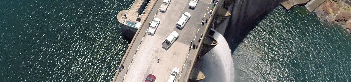
Project Description
|
Reservoir |
|
|---|---|
|
Catchment Area |
508,000 |
|
Capacity |
1.380 x 10⁹ |
|
Full Supply Level |
(FSL) 762 m |
|
Surface Area |
At FSL 23 |
|
Dam |
|
|---|---|
|
Type |
RCC Gravity Arch |
|
Height |
175m |
|
RCC Volume |
4.08 x10⁶ |
|
Spillway |
|
|---|---|
|
Type |
Crest Overflow with radial gates |
|
No. of Gates |
11 |
|
Width and height |
14m wide x 13m high |
|
Design capacity |
20,000m3/s |
|
Power Stations |
|
|---|---|
|
Type |
Two underground (One North and one South Bank) |
|
Installed Capacity |
2,400MW (2x1,200 MW) |
Current Status
- Reviewing of Engineering Feasibility Studies
- Reviewing of Environmental & Social Impact Assessment studies
- Securing of Finances for Implementation